Why Should Real Estate Agents Use Drone Photography for Listings?
In today's competitive real estate market, capturing buyer attention requires more than just standard ground-level photos. Properties often have unique features, expansive lots, or desirable surroundings that are difficult to convey from a conventional perspective. This challenge can make it harder for listings to truly stand out online and engage potential buyers effectively.
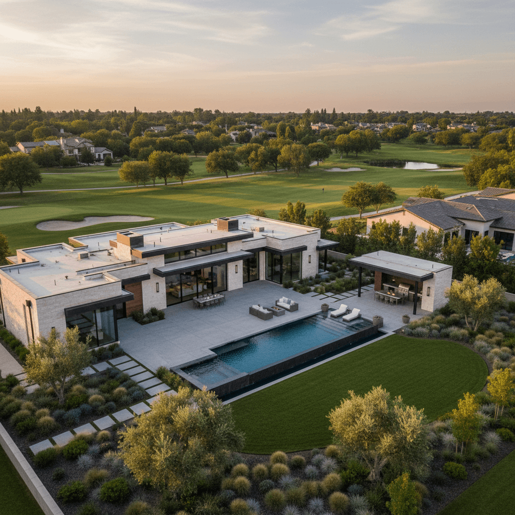
Direct Answer: Drone Photography Elevates Real Estate Listings
Real estate agents should use drone photography for listings because it offers unparalleled aerial perspectives that traditional photography cannot capture. Drones provide a bird's-eye view, showcasing the property's layout, size, boundaries, and its relationship to the surrounding landscape, amenities, and neighborhood. This comprehensive visual context helps potential buyers understand the property's full scope and appeal, creating a more engaging and informative listing.
Why This Matters for Real Estate Listings
Integrating drone photography into your listings can significantly impact sales velocity, buyer interest, and overall listing performance. Firstly, it creates an immediate "wow" factor, making your listing more memorable and shareable across platforms. Buyers can instantly grasp the property's scale, the expanse of the yard, or the proximity to desirable features like waterfronts, parks, or golf courses. This comprehensive view helps potential buyers envision themselves in the space and its environment, addressing common questions about lot size and location before they even ask. By providing this rich visual data upfront, you reduce ambiguity, build trust, and can potentially justify a higher asking price due to the perceived value and unique presentation of the property.
Common Mistakes Agents Make
While the benefits are clear, several common pitfalls can diminish the effectiveness or even legality of using drone photography:
- DIY Approach Without Expertise: Attempting to fly a drone and capture professional-quality footage without proper training, equipment, or understanding of composition can result in shaky, unappealing, or even unusable images.
- Ignoring Regulations: Operating a drone for commercial purposes without an FAA Part 107 license is illegal in the U.S. and can lead to hefty fines. Additionally, local airspace restrictions and privacy laws must be respected.
- Poor Weather Conditions: Flying a drone in windy, rainy, or overly cloudy conditions will yield low-quality, dull, or dangerous results, failing to highlight the property's best features.
- Focusing Only on the House: Neglecting to capture the surrounding context, neighborhood amenities, or property boundaries misses the main advantage of aerial views.
- Inconsistent Quality: Mixing professional drone shots with amateur ground photos can create a disjointed and unprofessional overall listing presentation.
How Professionals Approach This Differently
Professional real estate photographers specializing in drone operations bring a level of expertise and equipment that elevates the final product significantly. They are typically FAA-licensed and fully insured, ensuring legal compliance and mitigating risks. Professionals strategically plan each shot, considering lighting, property features, and surrounding points of interest to tell a compelling visual story. They use high-resolution drones equipped with stabilized cameras, capable of capturing stunning 4K video and high-detail stills. Furthermore, they apply expert post-processing techniques to enhance colors, correct exposure, and ensure the imagery is crisp, vibrant, and optimized for various listing platforms. This meticulous approach guarantees not only breathtaking visuals but also adherence to all safety and legal standards, providing a seamless and high-quality experience for both the agent and potential buyers.
FAQs
Is drone photography safe?
Yes, when conducted by licensed and experienced professionals who adhere to safety protocols and airspace regulations.
Can drone photos show property lines?
Professionals can overlay property line graphics onto aerial photos or videos, providing clear visual boundaries for buyers.
How long does a drone shoot take?
Typically, a drone shoot can be completed in 30-60 minutes, depending on property size and complexity.
Elevate Your Listings with Professional Aerial Views
To truly make your real estate listings soar above the competition, consider the distinct advantage of professional drone photography. Dooorbell offers comprehensive visual solutions, including expert drone services, to help agents, brokers, and property managers present their listings in the most compelling light possible.
Related Topics
Explore more insights on these related topics:
